GIS data for judicial districts in SA
The Department of Justice and Constitutional Development publishes KML files and PDF maps of the magisterial (magistrate’s court) districts on its website. Unfortunately there are some discrepancies between the KML file and the PDF maps, and between them and the point-to-point descriptions in the official notices published in the Government Gazette. I’ve constructed a dataset which attempts to resolve these discrepancies, as well as clean up gaps and overlaps in the polygons so that the edges match. This dataset is shared on GitHub at https://github.com/afrith/za-judicial-maps in case it is useful to anyone else.
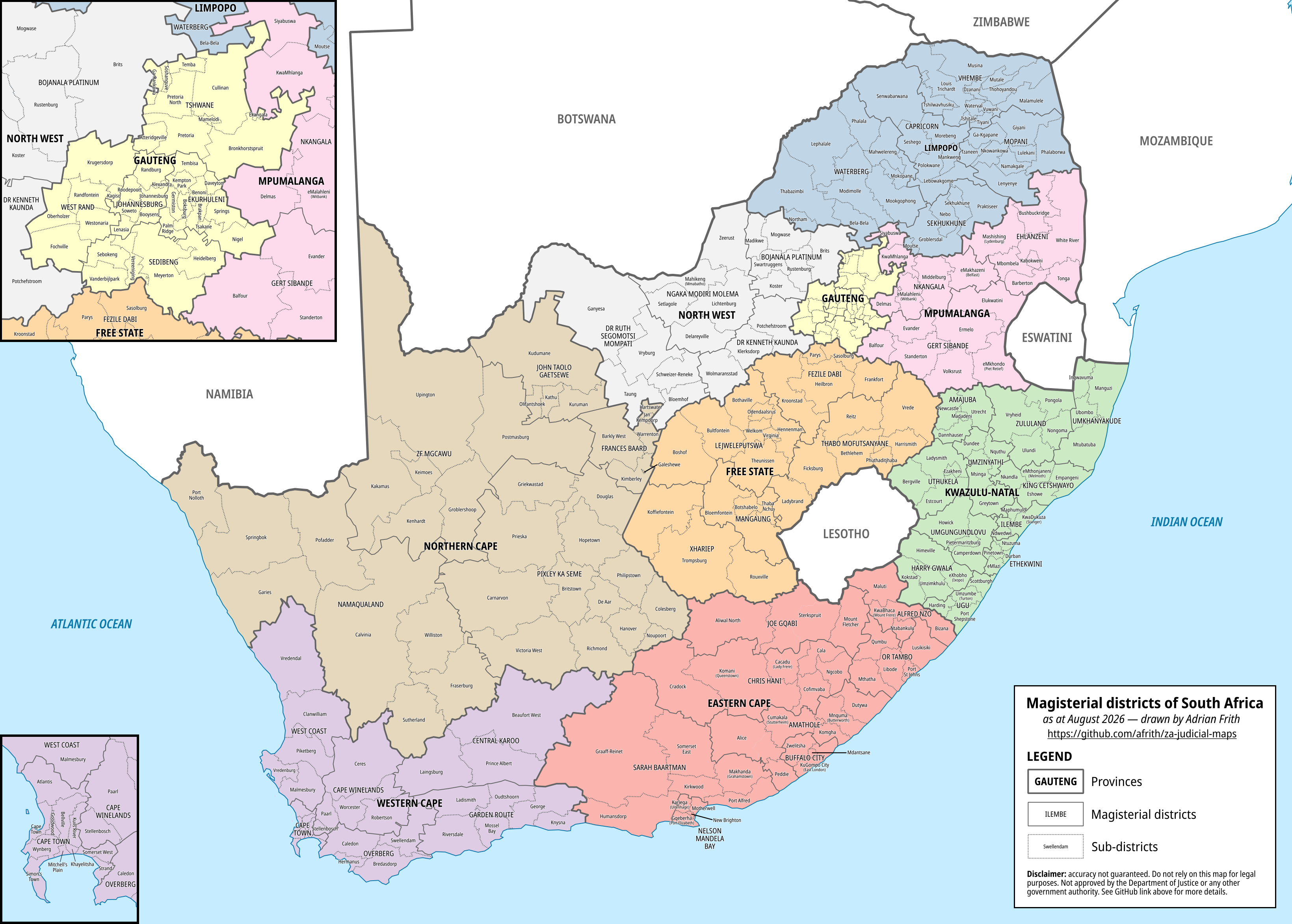
The README file in the repository goes into more detail about the data sources and the processing and cleanup I performed. Standard disclaimer that this is just my personal work, not legally authoritative nor guaranteed accurate, not approved by the government or by my employer, etc.
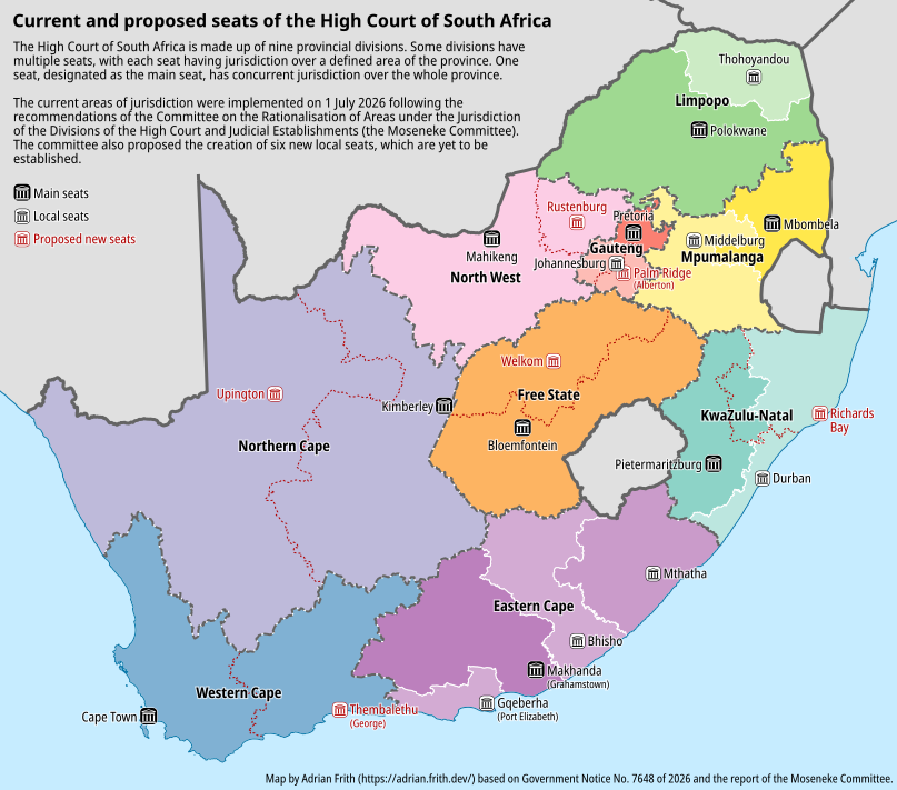
I’ve also included a dataset for the boundaries of the areas of jurisdiction of seats of the High Court, which were aligned to provincial boundaries as from 1 August 2026.