South African provinces as they might have been
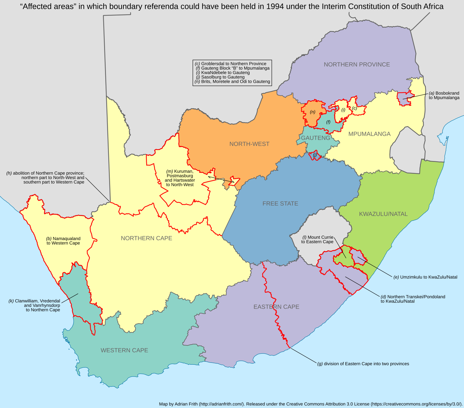
The post-apartheid political map of South Africa might well have looked quite different. The Eastern Cape might have been divided into two provinces, with the Kat River and Great Fish River on the boundary. The Northern Cape might not have existed, with the Western Cape meeting North West at the Orange River. Gauteng might have been much bigger – or much smaller. The Western Cape might have stopped south of Citrusdal – or it might have incorporated all of Namaqualand.
All of these boundary changes could have been carried out by referendums allowed for by the Interim Constitution. (A brief reminder: the Interim Constitution was negotiated in 1993; it governed the 1994 election and set up the Government of National Unity. It was replaced in 1998 by the final Constitution which we still have today.) The Interim Constitution set up the nine provinces we are familiar with, replacing the four old provinces, the “independent” TBVC countries, and the six “self-governing” homelands.
The process of drawing the provincial boundaries was complicated, hurried, and rather political.[1] To defer some of the decisions to the voters, the negotiatiors of the Interim Constitution defined fourteen “affected areas” in which referenda could be held to change the boundaries. Twelve of these were areas on the edges of provinces which might be transferred to an adjacent province. The remaining two were the Eastern Cape, which might be divided into two provinces; and the Northern Cape, which might be abolished, with its territory being transferred to the Western Cape and North West.[2] These are all shown in the map below.
There was a deadline of six months from after the 1994 general election for petitions to be submitted requesting referenda. As it turns out, none of the areas submitted petitions with enough signatures, so no referenda were held. Had they been, we might have avoided some of the conflicts that later sprung up in, amongst others, Bosbokrand and Matatiele.
Footnotes
[1] Griggs, R. (1998) The Security Costs of Party-Political Boundary Demarcations: The Case of South Africa. African Security Review 7(2).
[2] Constitution of the Republic of South Africa, Act 200 of 1993, section 124 and Schedule 1.
